Buyers do not read first. They look at the listing photos first. Every major real estate site shows the picture before the words. Including drone photos, with their sense of scale and grandeur, makes sense if you want a fast sale. As per statistics, listings with drone photos sell 68% faster. Data further shows that over 61% of realtors use drone aerial photography to market their listings.
Many agents skip aerial photography with drones because it seems like extra work. But buyers expect more context. Normal photos cannot show-
- Lot size
- Neighborhood feel
- How close the estate is to parks or highways
- The views or privacy
This high view is critical.
What is Drone Aerial Photography?
In simple terms, drone aerial photography services use a small flying camera to capture high-altitude views. But for real estate, it is much bigger than a simple picture. It tells the full story.
For a home, a drone shows you:
- The full size of the property.
- The neighborhood context.
- Parks, schools, and trails nearby.
- Angles you can never get from the street.
For big projects, it tracks:
- Construction progress.
- Plot lines and boundaries.
- Access roads for trucks.
You cannot get these perspectives with a normal handheld camera.
How Aerial Imaging Differs from Standard Ground Photography
Most of the listing photos tell a narrow story. They show rooms, hallways, and the front of the house. Aerial photos tell the whole story. They capture what really matters:
- Scope: Shows the house, yard, street, and neighborhood all in one picture.
- Scale: Reveals the true size, elevation, and layout of the property.
- Context: Shows how close the beach, park, or shops are.
- Position: Highlights where the home sits—on a corner, next to the lake, or far from others.
- Story: Makes the house feel bigger, better, and more unique.
Traditional photos answer the question: “What does the inside look like?” Aerial photos answer the question: “What is it like to live here?” That difference is huge. It is the main reason aerial listings sell faster.
Why This Visual Strategy Matters More Than Ever
The faster you grab attention, the faster the home sells. Buyers scroll fast. Algorithms push the most clicked listings to the top. In a busy market, you need an edge.
Drone photos give you that edge immediately:
- They boost clicks.
- They show true size and location.
- They create an emotional connection.
- They bring serious offers in the first week.
Photography is not just about documenting a house. It is about selling a lifestyle. A drone does this in one shot. But a raw photo is not enough.
Also read, how twilight & HDR photos boost property value — a visual strategy complement to aerial imagery.
Why Raw Drone Images Aren’t Enough
A mistake many teams make is assuming drone images look perfect straight out of the camera. They don’t.
Unedited drone shots typically include:
- distorted lines from wide-angle drone lenses
- washed-out skies
- uneven shadows on roofs or lawns
- parked cars, wires, neighbors’ clutter
- blown highlights from reflective siding
- glare on water or windows
- hazy atmosphere on overcast days
- distracting background elements
To buyers, these imperfections can make a great property look average, or worse, confusing. That’s where AI-enhanced drone image editing helps.
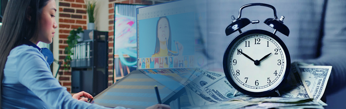
The Power of AI in Modern Aerial Real-Estate Imaging
AI has totally changed how we produce real estate photos. No one has to wait for days for manual fixes anymore. Agents and marketing teams now get finished aerial photos fast, at a fraction of the time.
This speed matters because real estate is a quick business. The first 72 hours a listing is live often decide how many inquiries you get. Faster photos mean faster publication. And faster publication means much stronger results right away.
By using AI in your real estate aerial photography, you can deliver high-volume editing, lightning speed, and consistent quality across all your listings. You can instantly fix issues like-
- Sky replacements on cloudy days
- Object removal (cars, wires, trash bins, signs)
- Lens correction for bent or warped lines
- Color grading for consistent tones
- Shadow reduction for clearer rooflines and lawns
- HDR balancing for exposure-correct images
- Glare removal on water or reflective surfaces
- Detail enhancement without over-sharpening
- Annotation overlays for developers and commercial assets
- Boundary mapping for large parcels
AI handles all the heavy lifting fast. Then, human editors step in to finalize the look – checking tone, brand consistency, and fine details. This hybrid workflow is now the industry standard for 2025.
Why Isn’t AI Alone Enough
AI doesn’t replace professional editing. It accelerates it. Human editors still manage nuance, problem-solving, and brand consistency. AI can clean up a sky, balance light, and remove distractions, but it doesn’t fully understand real estate storytelling.
For example:
- AI might remove a shadow but accidentally flatten contrast in the rest of the image.
- It might over-sharpen the roof shingles until they look unrealistic.
- It might apply white balance inconsistently across a set of 20 aerials.
- It can’t see whether the “feel” of the home aligns with your brand.
That is why the hybrid workflow wins: AI gets the photos 80% done. Human editors finish the last 20% which makes buyers truly connect.
How Hybrid Editing Improves Listing Performance
When AI and human editors work together, you get three huge benefits:
- Speed: You get images back in 24 to 48 hours, ready for MLS upload. This matches your tight schedule.
- Consistency: Your editing looks uniform, even when different photographers shoot your portfolio.
- More polished and marketable visuals: Polished aerial images highlight everything buyers care about:
- Property boundaries and layout.
- Neighborhood context and community amenities.
- Views and orientation
- Outdoor living potential
- Privacy and plot placement
This makes your listings more competitive and cuts down the time you need to scale.
Also read, real-estate photography tips for realtors: improving listing visuals and time-to-sell.
From Capture to Closing: The Complete Drone + AI Workflow
The drone shooting and AI editing process is much simpler than you think.
- Drone capture: A licensed operator shoots the property and gets the key aerial views that ground photos miss.
- AI steps in: The footage goes to AI. It instantly corrects lens lines, fixes exposure, replaces skies, and removes clutter and glare. This creates a clean, consistent baseline.
- Human refinement: Editors take over. They adjust the final colors, check realism, fix patchy lawns, and handle custom mapping overlays.
- Fast delivery: The final step is packaging, naming, and delivering polished, MLS-ready images, usually within 24 to 48 hours.
Choosing the Right Drone + AI Editing Vendor
Here are the five key criteria you must check while picking the right partner for your drone aerial photography:
| Criteria | What to look for | Questions to ask |
|---|---|---|
| 1. Safety & compliance | Ensures legally compliant and safe flight operations. | Are operators licensed (FAA/Part 107)? Do they have insurance? Do they know all no-fly zones? |
| 2. Editing quality | High-quality post-production tailored for aerial imagery. | Can they fix lenses and blend HDR? Do they offer sky replacement and object removal? Do they have drone-specific editing skills? |
| 3. AI workflow | Faster, consistent, and scalable editing with human oversight. | Do they use AI for batch consistency? Is the turnaround fast due to preprocessing? Is there human quality control (QC)? |
| 4. Bulk capacity | Ability to support high volumes (ideal for brokerages/agencies). | Can they handle 50–500 images per week? Do they have dedicated teams for large brokerage volumes? How do you manage peak load periods? |
| 5. Support & revisions | Reliable communication and flexible rework processes. | Is their revision policy clear? Can you see a sample before you commit? Will they use your custom style guide? |
Why SmartPHOTOeditors is Your Best Partner
Most teams want hybrid workflow results, but not the hassle of managing pilots, raw files, AI, and manual editing. That is where SmartPHOTOeditors (SPE) helps. We specialize in high-volume editing. We also run the exact blend of AI speed and human quality control that modern listings need.
Our service with drone photo editing that boosts property sales includes:
- Full enhancement: Sky replacement, object removal, lens correction, glare reduction, and exterior cleanup.
- Scale: Handling thousands of photos daily with total consistency.
- Capacity: Fast turnaround, white-label output, and bulk delivery options designed for MLS deadlines.
We give your teams the editing infrastructure you usually cannot run in-house, ensuring your listings move fast and look great.
| Vendor criteria | Why it matters | SmartPHOTOeditors capability |
|---|---|---|
| FAA / regional compliance | Legal and safety requirements for drone shoots | Works with globally compliant drone partners |
| High-quality editing portfolio | Proof of skill before outsourcing | SPE publishes a full real estate portfolio on our site |
| Sky replacement | Critical for improving exterior appeal | Yes |
| HDR blending | Needed for balanced outdoor lighting | Yes, provided for real estate images |
| Vertical line correction | Ensures clean architectural lines | Yes, part of SPE’s perspective correction |
| Lens distortion correction | Fixes drone wide-angle distortion | Included |
| Removing objects | Cars, wires, bins, signs, clutter | Fully supported |
| Lawn greening | Important across most markets | Included |
| Reflection/shadow removal | Cleans up windows, water, and pools | Included |
| AI-assisted workflow | Faster, consistent batch results | SPE uses a hybrid workflow |
| Human quality control | Essential for accuracy | Dedicated QC team reviews all edits |
| Bulk editing options | Needed for brokerages and agencies | Supports high-volume batching |
| Turnaround time | Important during peak listing seasons | Fast delivery based on urgency (24–48 hours typical) |
| Custom style guides | Ensures consistency across listings | SPE builds style profiles for clients |
| Revisions included | Reduces onboarding friction | Yes, structured revision process |
Conclusion
Aerial photography services give a clear competitive edge in real estate marketing. A listing that moves fast versus one that sits still often depends on one thing: how quickly and clearly the house shows its value online.
When you pair drone shots with AI cleanup and human editors, you get a repeatable system for producing sharp, consistent visuals every time.
- Drone capture gives you the right angles.
- AI gives you speed.
- Human editors give you accuracy.
SPE brings all three together so your listings can launch quickly, look consistent, and perform better, without overwhelming your internal team.
If you are ready to streamline your workflow without losing control of your style, SPE gives you the solution. Our hybrid approach blends AI speed with human accuracy. With our infrastructure, you get a reliable visual engine running behind your entire pipeline. Want to test the workflow on one of your drone shoots? Reach out to SmartPhotoeditors today.
FAQ’s
How much does drone photography cost for real estate listings?
The photo shoot for a home usually costs between $150 and $450, depending on where the house is and how big it is. Editing costs vary from $30 to $150, based on the work needed.
What types of real estate properties benefit most from aerial drone photography plus AI enhancements?
Luxury homes, waterfront properties, very large lots, commercial buildings, new developments, and any listing where showing the size, location, or context is important.
How does AI come into play with drone & aerial photo workflows for real estate?
AI handles common concerns like sky replacement, contrast and highlight issues, color fixes, glare removal, and object cleanup to keep large batches of photos consistent. It speeds up delivery and creates a clean starting point for human editors.
How do you choose the right drone/photography service or vendor partner for real estate aerials + AI?
Check for safety compliance, strong editing skills, whether they use a hybrid workflow, how fast they deliver, whether they can handle large volumes, and whether they have a clear policy for making revisions. Always look at the portfolio first.
SmartPHOTOeditors
 Prev
Prev